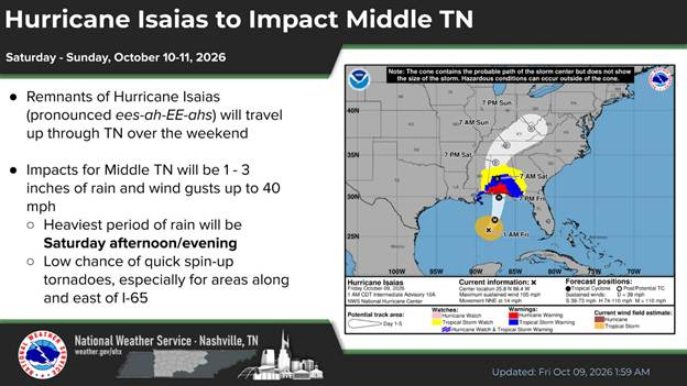
The remnants of Hurricane Isaias (pronounced ees-ah-EE-ahs) are expected to move through Tennessee over the weekend, bringing periods of heavy rain and gusty winds to Middle Tennessee. The Nashville Office of Emergency Management (OEM) urges everyone to stay weather aware.
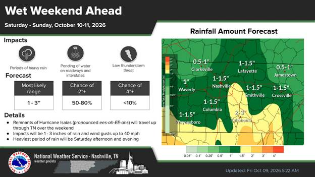
The Nashville Office of the National Weather Service forecasts indicate 1 to 3 inches of rainfall across the region, with the heaviest rain expected Saturday and Saturday night.
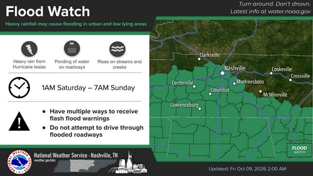
In anticipation of these conditions, the NWS issued a Flood Watch beginning late Friday night and through the day on Saturday.
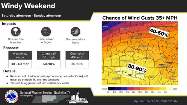
In addition to heavy rainfall, residents should prepare for wind gusts between 30 and 40 mph as the storm system moves through Middle Tennessee.
These winds, combined with saturated ground, may lead to downed trees, isolated power outages, and hazardous travel conditions.
Weather forecasts can change quickly.
Remember these safety tips:
• Monitor local weather updates throughout the weekend
• Use caution on roadways, especially in areas prone to flooding
• Avoid driving through flooded streets — Turn Around, Don’t Drown
• Secure outdoor items that could become airborne in gusty winds
To prepare for protentional heavy rain Metro Water Services reminds you to check nearby storm drains and clear them if they have leaves or other debris on top of them to help prevent localized flash flooding.
Metro Water Services has crews out checking and cleaning as well.
OEM is actively monitoring the situation and will provide updates as conditions evolve. NFD has swift water rescue teams on call and OEM response for flooding on call.
For important safety information and weather updates sign up for the Metro Emergency Alert & Notification System. (MEANS) It is free to download.
NES Power Outage Center
NES Power Outage Tips
TDOT Smartway Map
Food Safety During a Power Outage