Unstable weather is forecast to move into the area this week. Now is the time to prepare and make sure you have multiple ways to receive weather alerts.
The Nashville Office of the National Weather Service (NWS) forecast rain & thunderstorms will develop across Middle Tennessee on Thursday, with a low chance that a few storms will become severe, mainly during the afternoon through early evening.
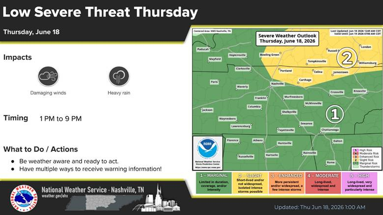
There is a marginal risk (mostly level 1 out of 5) of severe storms Thursday, from mid afternoon into the early evening, with damaging winds & heavy rainfall being the main threats.
A marginal risk is the lowest level on the NWS Storm Prediction Scale. Most storms will be weak or short-lived. However, one or two storms may briefly become severe.
Rain chances will resume by late Saturday and continue into next week.
What to Expect
- Low severe threat this afternoon and evening
- Primary concerns will be gusty winds and localized flooding
- Temporarily dry out Friday, but shower and storm chances return this weekend
- Warm and humid conditions persist next week with daily shower chances
For important safety information and weather updates sign up for the Metro Emergency Alert & Notification System. (MEANS) It is free to download.
Prepare for Thunderstorms
NES Power Outage Center
NES Power Outage Tips
Food Safety in a Disaster or Emergency
TDOT Smartway Map