The Nashville Office of Emergency Management (OEM) reminds everyone to stay weather aware as unstable weather is forecast to move into the area Monday, June 22, 2026. Now is the time to prepare and make sure you have multiple ways to receive weather alerts.
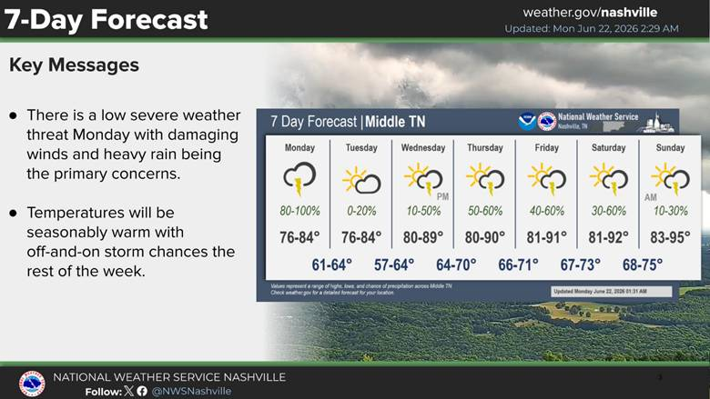
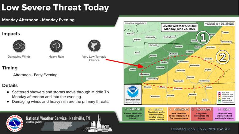
The Nashville Office of the National Weather Service (NWS) forecast showers and storms to develop Monday afternoon and continue into Monday evening. Some storms could become severe, with damaging winds, lightning, and heavy rain being the main concerns. There is a very low tornado chance.
There is a marginal risk (mostly level 1 out of 5) of severe storms. A marginal risk is the lowest level on the NWS Storm Prediction Scale. Most storms will be weak or short-lived. However, one or two storms may briefly become severe.
What to Expect
- Low severe threat Monday afternoon and evening
- Primary concerns will be gusty winds and heavy rain
- There is a low tornado risk south of I-40
- Rain chances continue this week, with temperatures warming into the low 90s.
Some areas along the Tennessee river could see 2-3” over the next 5 days.
For important safety information and weather updates sign up for the Metro Emergency Alert & Notification System. (MEANS) It is free to download.
Prepare for Thunderstorms
NES Power Outage Center
NES Power Outage Tips
Food Safety in a Disaster or Emergency
TDOT Smartway Map