
The East Bank development is a transformational and complex project that has various public and private pieces to it.
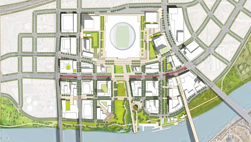
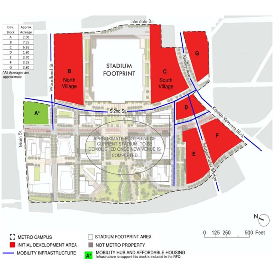
The current focus for Metro in 2024 is the development of the Initial Development Area (IDA) of Metro-owned land. This IDA is approximately 30 of the 130 Metro-owned acres and focuses on the development of seven parcels for development.
These parcels are separate from the development and construction of the football stadium, which was approved by Metro Council in April 2023.
Negotiations with Master Developer, The Fallon Company, began in October 2023 and concluded in February 2024. The Metro Council unanimously approved the Ordinance for the Master Developer contract in April 2024.
What area makes up the East Bank?
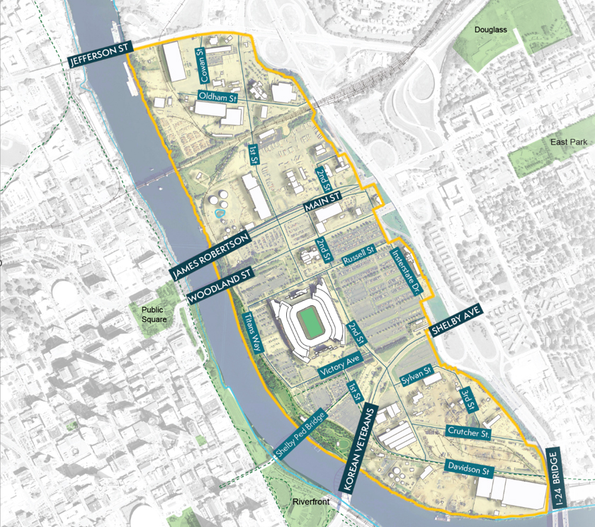
It's important to understand there are four ways to discuss the East Bank at this moment and its scope. While the area north of Jefferson Street to Interstate 65 – River North and Oracle – was not included in the Imagine East Bank Vision Plan, infrastructure for these areas are shared and vital to be thought about in the same context, which is why today you will hear the East Bank described as an area of more than 500 acres from Interstate 24 at the Cumberland River to where Interstate 65 crosses the river.
- Entire East Bank - 550 Acres, from SA Recycling Scrap Yards to Oracle
- Imagine East Bank Study Area - During the Imagine East Bank Study, the Planning Department looked at an area of roughly 330 Acres from Jefferson Street south to Interstate 24
- Metro Owned Land - +/- 130 Acres (including ROW)
- Initial Development Area - 30 Acres
These areas are pictured below. Click or tap the images to view a larger size.
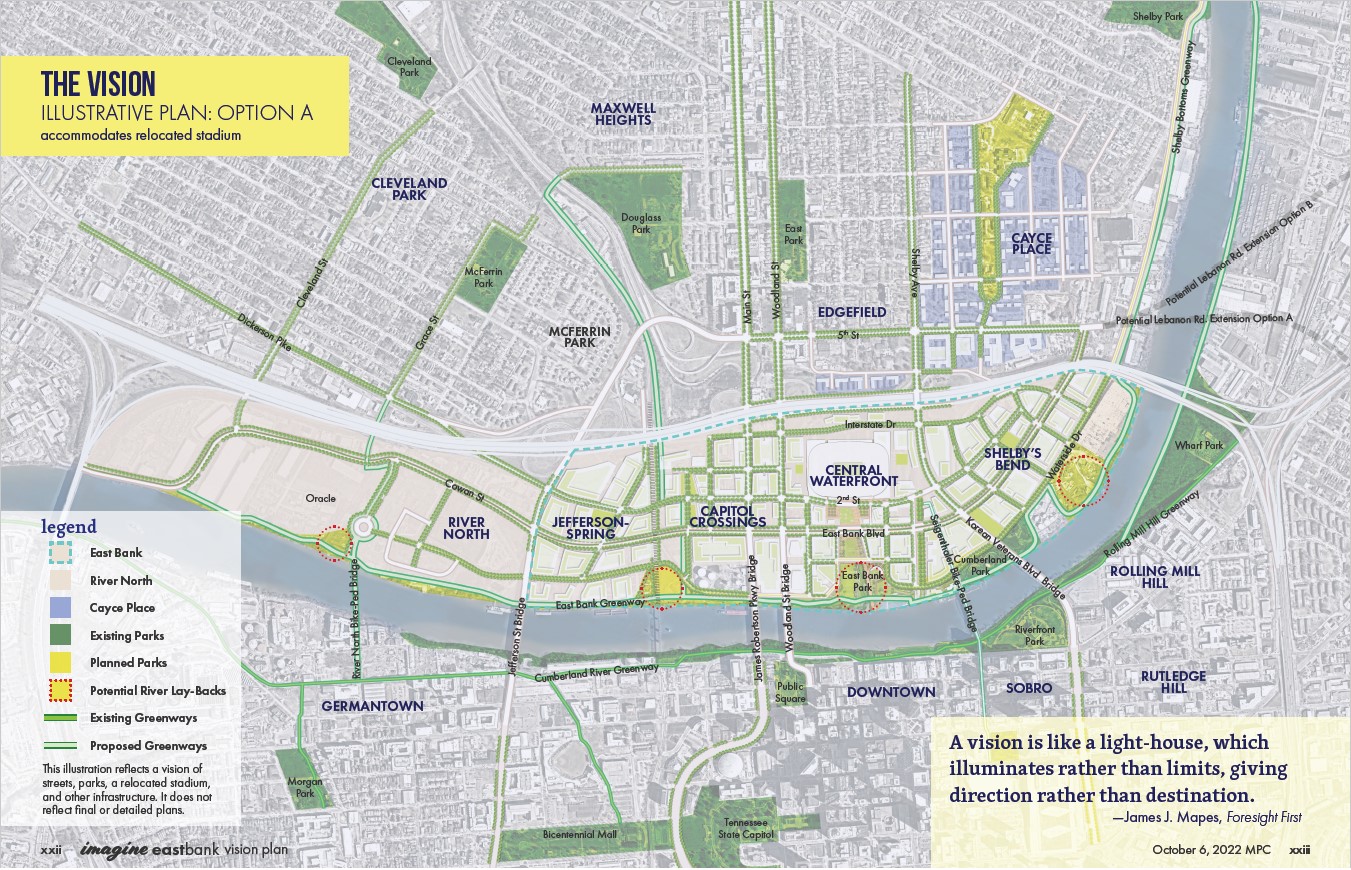
Entire East Bank
Imagine East Bank Study area
Metro-owned land
Initial Development Area
What was discussed as part of the negotiations?
The negotiations that the Administration has undertaken include the development of the Initial Development Area. Items being included as part of negotiations are:
- Draft Master Plan
- Rezoning Process: Downtown Code (DTC) Expansion
- Land Uses Under Discussion
- Tennessee Performing Arts Center (TPAC)
- Infrastructure
- Affordable Housing
- Small, Minority, Women-Owned Businesses and Enterprise Targets
Who is leading the negotiations?
A team from the O'Connell administration, led by Chief Development Officer Bob Mendes, are handling negotiations with the Fallon Company for the rights to develop a portion of the Metro-owned land known as the IDA.
What's going on with TPAC?
The State has provided TPAC with funding to move from its current location on Deaderick Street. TPAC and Metro have entered into a Memorandum of Understanding (MOU) for TPAC to make its home on the East Bank on Parcel E of the IDA, adjacent to the John Seigenthaler Pedestrian Bridge.
As part of the MOU, the total investment in infrastructure by TPAC will be described fully. The investment in infrastructure will included, but not be limited to, public roads – sidewalks, bike facilities, plazas, etc., public utilities that service the structure, modifications to the Seigenthaler Pedestrian Bridge, etc.
Who is responsible for financing the development of the IDA?
There is a mix of public and private funding to help finance the infrastructure within the IDA.
Related Tags
Last updated: May 20, 2024 at 1:11 PM